

Road trip routes / Punjab
Islamabad to Kohala Bridge
7.1h
Drive time
204 km
Distance
Opens turn-by-turn directions in your Maps app. This is a planning route, not a live booking or road-condition guarantee.
Route Details
Times assume a 7:00 AM start — a planning estimate, not a schedule.
7:00 AM
Daman-e-Koh (Start)
A panoramic viewpoint over Islamabad and Rawalpindi, 10 km from the city.
7:28 AM
Margalla Hills
Hiking trails and viewpoints along the expressway's start.
9 km · 0.5 h from Daman-e-Koh
8:29 AM
Rawal Lake
A lake with boating and parkland, about 30 minutes from the city centre.
21 km · 1 h from Margalla Hills
8:45 AM
Barakahu
The start of the Murree Expressway proper.
10 km · 0.3 h from Rawal Lake
10:04 AM
Bhurban
A hill-station resort area with a golf course and pine forest, just below Murree.
58 km · 1.3 h from Barakahu
10:36 AM
Murree
Pakistan's most popular hill station, with Kashmir Point and the Mall Road bazaar.
11 km · 0.5 h from Bhurban
10:44 AM
Pindi Point
A chairlift and cable car viewpoint in Murree.
2 km · 0.1 h from Murree
11:31 AM
Patriata (New Murree)
A chairlift and cable car up a pine ridge, with an amusement park at the top.
18 km · 0.8 h from Pindi Point
12:03 PM
Lower Topa
A viewpoint on the road toward Kohala.
8 km · 0.5 h from Patriata (New Murree)
12:20 PM
Sunny Bank
A picnic spot with valley views.
7 km · 0.3 h from Lower Topa
12:35 PM
Ghora Gali
A historic pine-forested area on the old Murree road.
7 km · 0.3 h from Sunny Bank
1:39 PM
Dewal Sharif
A shrine and village on the descent toward Kohala.
39 km · 1.1 h from Ghora Gali
2:04 PM
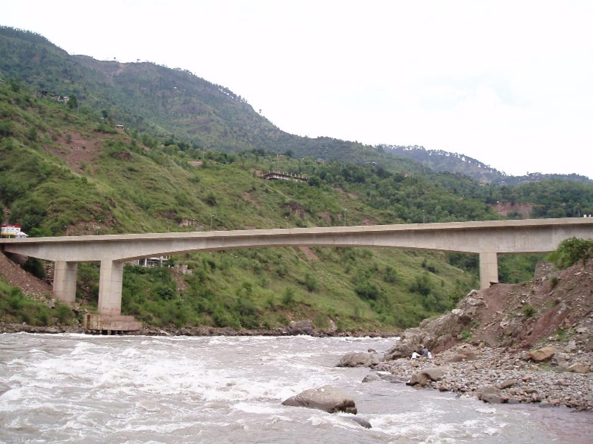
Kohala Bridge (End)
The historic bridge over the Jhelum River, the gateway to Azad Jammu and Kashmir, with riverside restaurants known for white trout.
14 km · 0.4 h from Dewal Sharif
Road Trip Routes / Islamabad to Kohala Bridge
Islamabad to Kohala Bridge
The Murree Expressway run from the capital's own Margalla Hills, through Bhurban and Murree's hill stations and the Patriata chairlift, down to Kohala Bridge, the historic gateway from Punjab into Azad Jammu and Kashmir.
Distance
204 km
Drive time
7.1 h
Best time to go
Year-round for Islamabad and Murree; March to November is most comfortable for the hill stations.
Road conditions
Fully paved dual carriageway (Murree Expressway) for most of the route, narrowing to a mountain road through Murree and down to Kohala.
Route Overview
The Murree Expressway run from the capital's own Margalla Hills, through Bhurban and Murree's hill stations and the Patriata chairlift, down to Kohala Bridge, the historic gateway from Punjab into Azad Jammu and Kashmir.
Stop by Stop
In driving order. Significant stops link to their own field guide; the rest are labelled waypoints along the way.
Daman-e-Koh
A panoramic viewpoint over Islamabad and Rawalpindi, 10 km from the city.
Margalla Hills
Hiking trails and viewpoints along the expressway's start.
9 km · 0.5 h from the previous stop
Rawal Lake
A lake with boating and parkland, about 30 minutes from the city centre.
21 km · 1 h from the previous stop
Barakahu
The start of the Murree Expressway proper.
10 km · 0.3 h from the previous stop
Bhurban
A hill-station resort area with a golf course and pine forest, just below Murree.
58 km · 1.3 h from the previous stop
Murree
Pakistan's most popular hill station, with Kashmir Point and the Mall Road bazaar.
11 km · 0.5 h from the previous stop
Pindi Point
A chairlift and cable car viewpoint in Murree.
2 km · 0.1 h from the previous stop
Patriata (New Murree)
A chairlift and cable car up a pine ridge, with an amusement park at the top.
18 km · 0.8 h from the previous stop
Lower Topa
A viewpoint on the road toward Kohala.
8 km · 0.5 h from the previous stop
Sunny Bank
A picnic spot with valley views.
7 km · 0.3 h from the previous stop
Ghora Gali
A historic pine-forested area on the old Murree road.
7 km · 0.3 h from the previous stop
Dewal Sharif
A shrine and village on the descent toward Kohala.
39 km · 1.1 h from the previous stop
Kohala Bridge
The historic bridge over the Jhelum River, the gateway to Azad Jammu and Kashmir, with riverside restaurants known for white trout.
14 km · 0.4 h from the previous stop