

Field guides / Diamer Division / Diamer / Nanga Parbat
Field guide · Mountains
Diamer Division
Diamer District · Gilgit-Baltistan, Pakistan
Nanga Parbat
One of Pakistan's major eight-thousanders, commonly approached through Fairy Meadows.
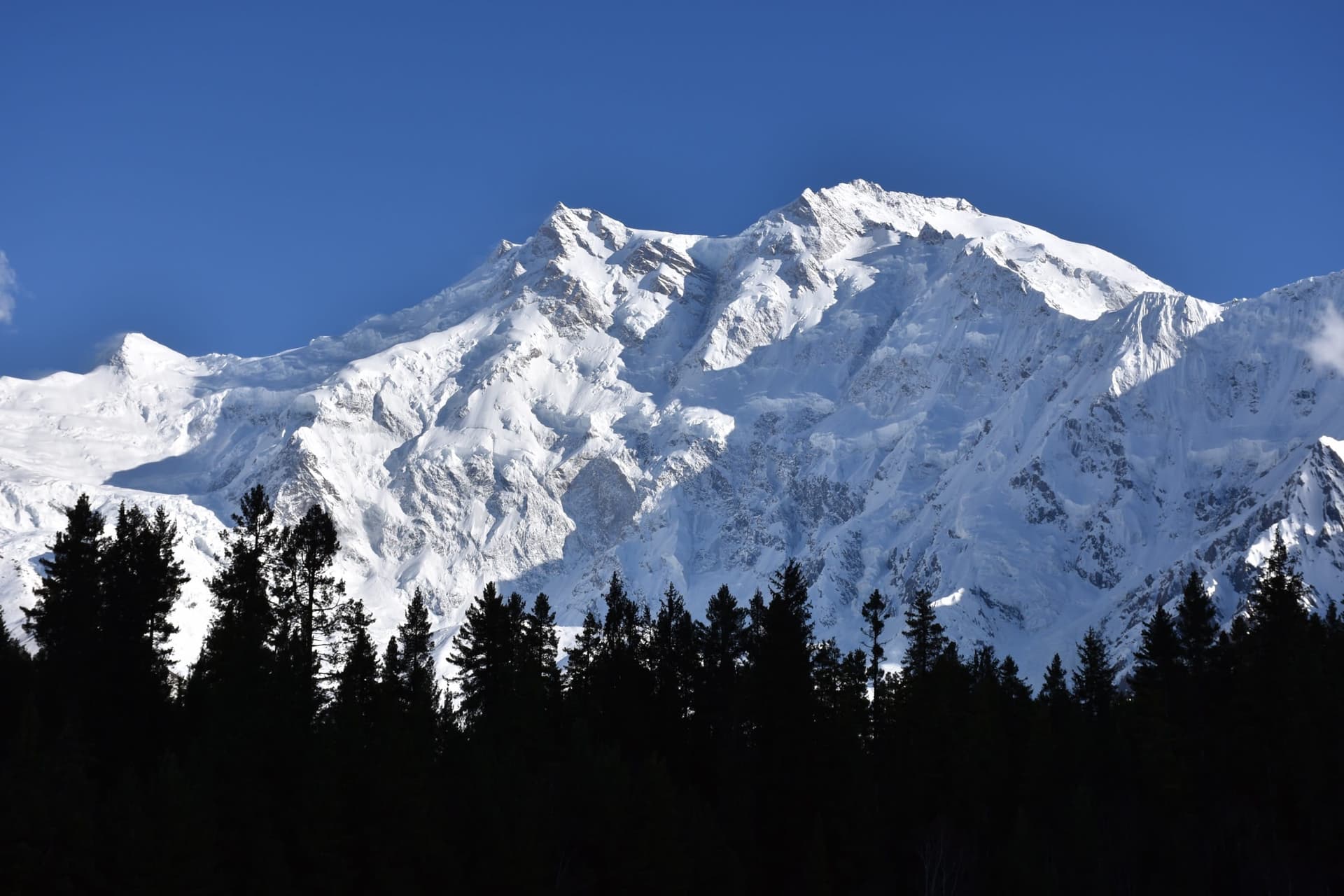
Nanga Parbat is the ninth-highest mountain on Earth at 8,126 m and the western anchor of the entire Himalayan range, the point where the Himalaya finally give out above the Indus. Its nickname, the 'Killer Mountain', was earned in the 1930s when a series of German expeditions cost dozens of lives before the first ascent in 1953. The peak presents two utterly different faces to travellers: the gentle pine meadows of Fairy Meadows on the north (Raikot) side, and the colossal Rupal Face on the south, at around 4,600 m the highest mountain wall on the planet.
Why go
- ✦8,126 m, ninth-highest peak on Earth
- ✦Fairy Meadows north-side panorama
- ✦The Rupal Face, highest mountain wall in the world
- ✦Beyal Camp and Nanga Parbat Base Camp trek
- ✦The 'Killer Mountain' climbing history
Two Faces of the Mountain
Nanga Parbat is really two destinations. The north, Raikot side is soft and approachable, alpine meadow, pine forest, and the ice wall rising directly overhead from Fairy Meadows. The south, Rupal side is severe and immense, a near-vertical 4,600-metre face that mountaineers regard as one of the great challenges in the sport. Most travellers experience the meadows; only expeditions take on Rupal.
The Killer Mountain
The peak's reputation was forged in tragedy. German and Austrian expeditions through the 1930s suffered repeated disasters, avalanches and storms killing climbers and porters, before the Austrian Hermann Buhl made an extraordinary solo first ascent in 1953. The history hangs over the mountain and is part of why standing beneath it feels so charged.
Trekking and Acclimatisation
The Fairy Meadows trek is short but the altitude and sun exposure are real, so an unhurried pace and an extra night pay off. From the meadows, a day walk continues to Beyal Camp and on toward the Raikot base camp for closer views of the ice. Carry layers, mountain weather turns fast even in summer.
Planning tip
Best Time to Visit, May to September for the meadows, viewpoints, and trekking; the trail can hold snow in early season. Winter belongs to elite specialists only.
Getting there, For the classic view, take the Karakoram Highway to Raikot Bridge, then a jeep up the notorious cliff track to Tato and a half-day walk to Fairy Meadows. The Rupal Face is reached separately from Astore. Both sides need local guides and time to acclimatise.
Allow, Two to four days for Fairy Meadows and the Beyal Camp viewpoint; longer for Rupal-side base-camp views.
What to Do
Make Nanga Parbat Part of a Trip
GreenPak resorts and journeys within 5 km of Nanga Parbat.
Nearby
Straight-line distance from Nanga Parbat, within 5 km.
Nothing else genuinely close by (within 5 km of Nanga Parbat) is published yet.