

Road trip routes / Azad Jammu and Kashmir
Neelum Valley: Muzaffarabad to Taobat
18.1h
Drive time
282 km
Distance
Opens turn-by-turn directions in your Maps app. This is a planning route, not a live booking or road-condition guarantee.
Route Details
Times assume a 7:00 AM start — a planning estimate, not a schedule.
7:00 AM
Muzaffarabad (Start)
The capital of Azad Jammu and Kashmir, at the confluence of the Neelum and Jhelum rivers, and the starting point for the drive up the valley.
8:54 AM
Dhani Waterfall
A tall waterfall dropping right onto the road about 40 km from Muzaffarabad, with roadside tea stalls.
38 km · 1.9 h from Muzaffarabad
9:08 AM
Neelum-Jhelum Dam
A viewpoint over the Neelum-Jhelum hydropower project.
5 km · 0.2 h from Dhani Waterfall
—
Chilhana / Teetwal
A border viewpoint where the Neelum River itself marks the boundary between Pakistani and Indian-administered Kashmir.
—
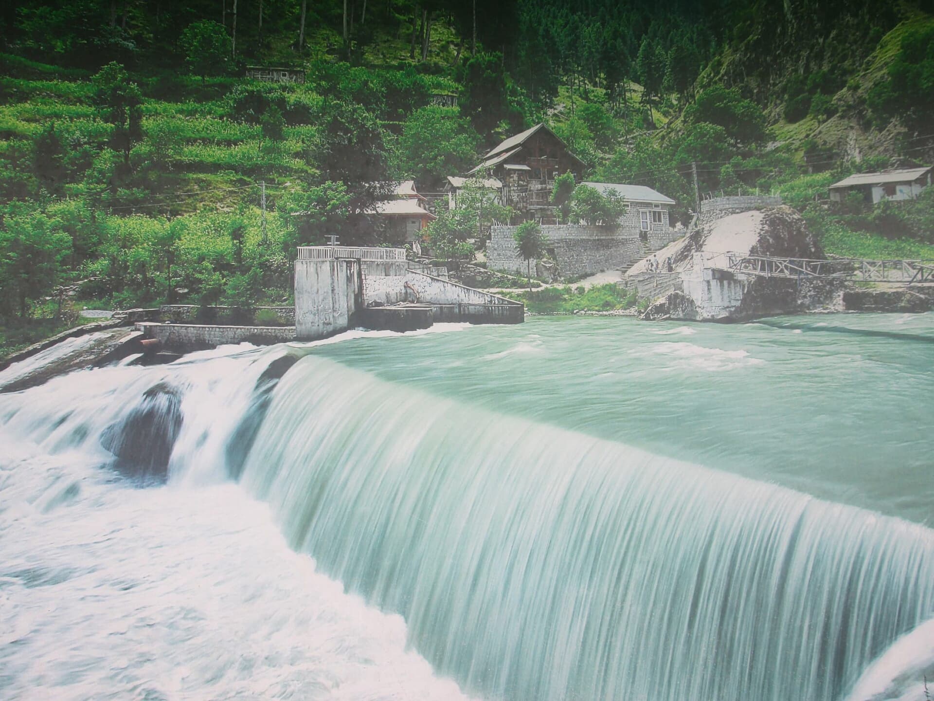
Kutton Waterfall
A wide weir on the Jagran River near Kundal Shahi, where the pine-forested Jagran Valley meets the Neelum road.
10:03 AM
Baboon Valley
A jeep-track side valley reached from Kundal Shahi/Kutton, with meadows and streams.
12 km · 0.9 h from Kutton Waterfall
11:42 AM
Athmuqam
District headquarters of Neelum, with river views and a small bazaar.
26 km · 1.7 h from Baboon Valley
12:24 PM
Keran & Upper Neelum
A riverside village on the LOC, with India visible across the water.
11 km · 0.7 h from Athmuqam
1:37 PM
Dowarian
The base village for the trek up to Ratti Gali Lake.
21 km · 1.2 h from Keran & Upper Neelum
3:24 PM
Ratti Gali Lake
A high-altitude glacial lake, 1-2 hours' trek above Dowarian.
12 km · 1.8 h from Dowarian
6:37 PM
Sharda
The valley's largest town, home to the ancient Sharda Peeth university ruins.
40 km · 3.2 h from Ratti Gali Lake
7:41 PM
Kel
The last town in the valley with a proper road, and the gateway to Arang Kel and the jeep track onward.
21 km · 1.1 h from Sharda
—
Arang Kel
A storybook meadow village above Kel, reached by chairlift and a short walk.
9:22 PM
Shounter Valley
A high side-valley detour from Kel, with the mirror-still Shounter Lake.
28 km · 1.7 h from Arang Kel
9:50 PM
Chitta Katha Lake
A remote glacial lake reached by a demanding trek above Shounter.
7 km · 0.5 h from Shounter Valley
11:51 PM
Janwai
A small settlement on the Kel-Taobat jeep track.
38 km · 2 h from Chitta Katha Lake
12:37 AM (Day 2)
Halmat
A cluster of hamlets, Sardari, Hilmat and Makroon among them, with traditional wooden houses along the jeep track.
16 km · 0.8 h from Janwai
12:56 AM (Day 2)
Taobat
The last village of the Neelum Valley at 7,500 ft, where the Kishenganga River becomes the Neelum.
6 km · 0.3 h from Halmat
1:04 AM (Day 2)
Taobat Bala (End)
A 30-40 minute hike above Taobat for panoramic views over Pakistan's last village.
3 km · 0.1 h from Taobat
Road Trip Routes / Neelum Valley: Muzaffarabad to Taobat
Neelum Valley: Muzaffarabad to Taobat
The full Neelum River corridor from the AJK capital at Muzaffarabad, past waterfalls, Sharda's ancient university ruins and Kel's gateway villages, to Taobat, the last village in Pakistan before the Kishenganga becomes the Neelum.
Distance
282 km
Drive time
18.1 h
Best time to go
June to September; the Kel-Taobat jeep track and side valleys are only reliably open in these months.
Road conditions
Muzaffarabad to Sharda is a metalled road in good condition. Sharda to Kel is decent but narrower. Kel to Taobat is a 4x4 jeep track only, about 2 hours.
Route Overview
The full Neelum River corridor from the AJK capital at Muzaffarabad, past waterfalls, Sharda's ancient university ruins and Kel's gateway villages, to Taobat, the last village in Pakistan before the Kishenganga becomes the Neelum.
Stop by Stop
In driving order. Significant stops link to their own field guide; the rest are labelled waypoints along the way.
Muzaffarabad
The capital of Azad Jammu and Kashmir, at the confluence of the Neelum and Jhelum rivers, and the starting point for the drive up the valley.
Dhani Waterfall
A tall waterfall dropping right onto the road about 40 km from Muzaffarabad, with roadside tea stalls.
38 km · 1.9 h from the previous stop
Neelum-Jhelum Dam
A viewpoint over the Neelum-Jhelum hydropower project.
5 km · 0.2 h from the previous stop
Chilhana / Teetwal
A border viewpoint where the Neelum River itself marks the boundary between Pakistani and Indian-administered Kashmir.
Kutton Waterfall
A wide weir on the Jagran River near Kundal Shahi, where the pine-forested Jagran Valley meets the Neelum road.
Baboon Valley
A jeep-track side valley reached from Kundal Shahi/Kutton, with meadows and streams.
12 km · 0.9 h from the previous stop
Athmuqam
District headquarters of Neelum, with river views and a small bazaar.
26 km · 1.7 h from the previous stop
Keran & Upper Neelum
A riverside village on the LOC, with India visible across the water.
11 km · 0.7 h from the previous stop
Dowarian
The base village for the trek up to Ratti Gali Lake.
21 km · 1.2 h from the previous stop
Ratti Gali Lake
A high-altitude glacial lake, 1-2 hours' trek above Dowarian.
12 km · 1.8 h from the previous stop
Sharda
The valley's largest town, home to the ancient Sharda Peeth university ruins.
40 km · 3.2 h from the previous stop
Kel
The last town in the valley with a proper road, and the gateway to Arang Kel and the jeep track onward.
21 km · 1.1 h from the previous stop
Arang Kel
A storybook meadow village above Kel, reached by chairlift and a short walk.
Shounter Valley
A high side-valley detour from Kel, with the mirror-still Shounter Lake.
28 km · 1.7 h from the previous stop
Chitta Katha Lake
A remote glacial lake reached by a demanding trek above Shounter.
7 km · 0.5 h from the previous stop
Janwai
A small settlement on the Kel-Taobat jeep track.
38 km · 2 h from the previous stop
Halmat
A cluster of hamlets, Sardari, Hilmat and Makroon among them, with traditional wooden houses along the jeep track.
16 km · 0.8 h from the previous stop
Taobat
The last village of the Neelum Valley at 7,500 ft, where the Kishenganga River becomes the Neelum.
6 km · 0.3 h from the previous stop
Taobat Bala
A 30-40 minute hike above Taobat for panoramic views over Pakistan's last village.
3 km · 0.1 h from the previous stop