

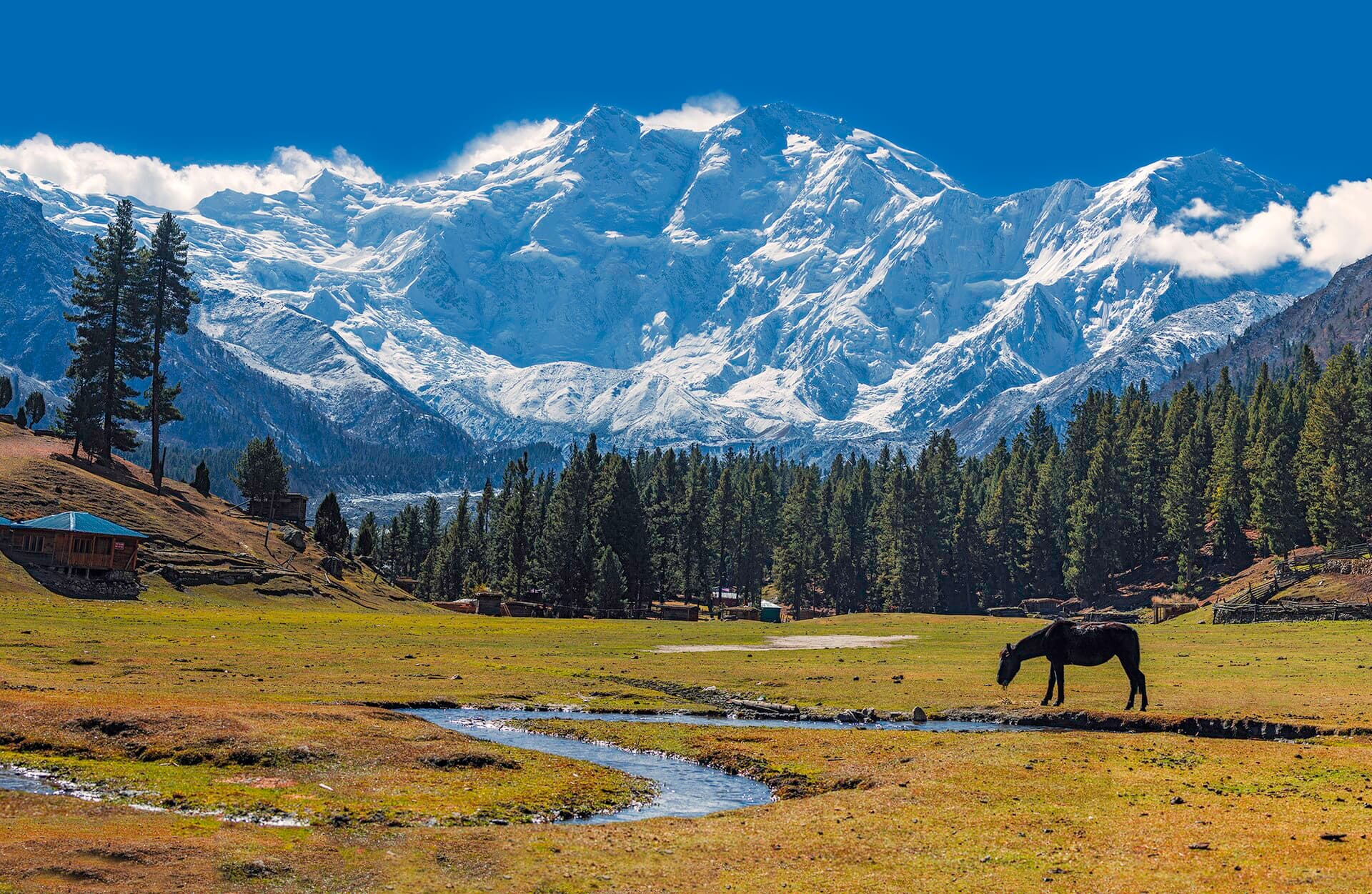
The Great Mountains of Northern Pakistan
Where Three Mountain Worlds Meet
In northern Pakistan, the Himalaya, Karakoram and Hindu Kush come together in a landscape of immense peaks, glaciers, rivers and high-altitude valleys. K2 rises above the glaciers of Baltistan, Nanga Parbat anchors the western Himalaya, and Tirich Mir dominates the Hindu Kush of Chitral. Between them lie historic settlements, mountain passes, alpine plateaus and communities shaped by altitude, climate and geography.
- great mountain ranges
- 3
- great mountain ranges
- eight-thousand-metre peaks
- 5
- eight-thousand-metre peaks
- glaciers, 2024 inventory
- 13,032
- glaciers, 2024 inventory
- K2, highest summit
- 8,611 m
- K2, highest summit
Pakistan's mountain north
At a Glance
3
Great mountain ranges
The Himalaya, Karakoram and Hindu Kush shape the northern highlands of Pakistan.
5
Eight-thousand-metre peaks
Four rise in the Karakoram around Baltoro–Concordia, and Nanga Parbat stands in the western Himalaya.
13,032
Documented glaciers
Recorded in a national glacier inventory announced by the Government of Pakistan in 2024.
Source: 2024 inventory
8,611 m
K2, Pakistan's highest mountain
The highest summit of the Karakoram and the second-highest mountain on Earth.
One Country, Three Mountain Identities
Pakistan's three great northern mountain ranges are geographically connected, but each has a distinct character. The Himalaya offers isolated peaks, alpine meadows, forests and high plateaus. The Karakoram is defined by steep granite towers, extensive glacier systems and four of Pakistan's five eight-thousanders. The Hindu Kush shapes the valleys of Chitral and western Gilgit-Baltistan through high passes, forested slopes and living cultural landscapes. Together, they form one of Pakistan's most remarkable geographical regions, stretching across Gilgit-Baltistan, Khyber Pakhtunkhwa and the northern Himalayan areas of the country.
Geographic orientation
Where the Ranges Lie
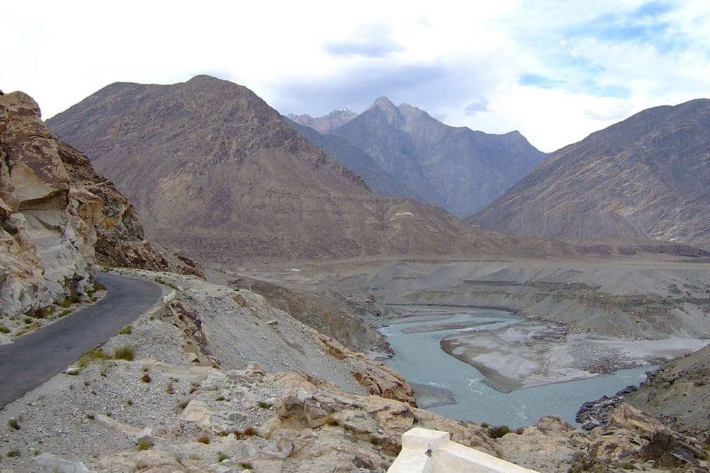
The Hindu Kush rises in the west around Chitral, the Karakoram forms the high-mountain core of Gilgit-Baltistan in the northeast, and the western Himalaya reaches into the south around Nanga Parbat and Astore. The upper Indus River threads between them, and the three systems come into close geographic contact near Jaglot and Bunji.
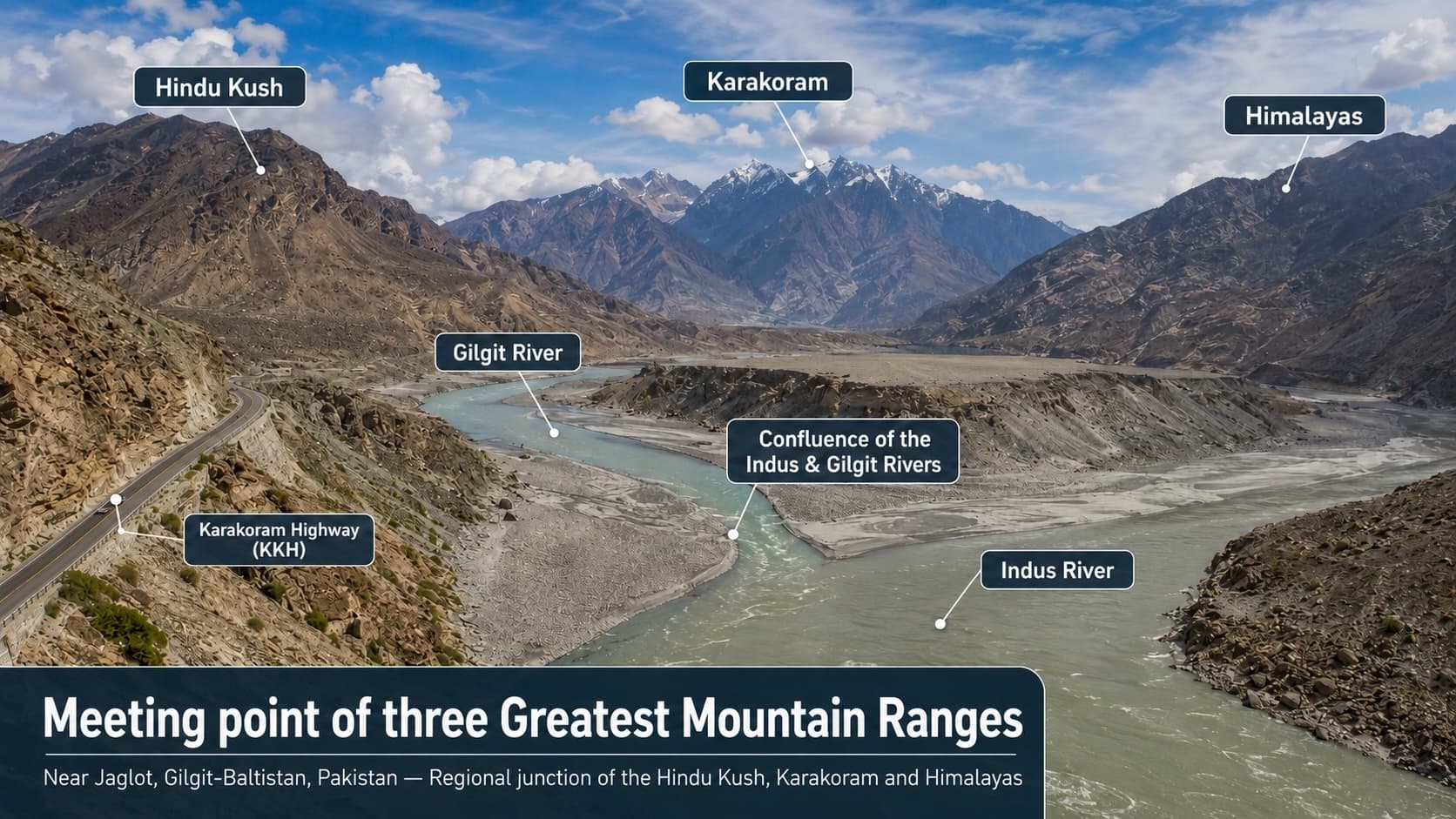
Near Jaglot, Gilgit-Baltistan — the regional junction of the Hindu Kush, Karakoram and Himalayas, where the Gilgit River meets the Indus. Labels mark the ranges by direction, not their boundaries. Use it for orientation only, not for navigation.
Range legend
- HimalayaWestern anchor: Nanga Parbat and the Diamer / Astore highlands
- KarakoramPakistan's highest concentration of 7,000m+ and 8,000m+ peaks
- Hindu KushChitral's high valleys and passes, west of the Karakoram
Himalaya
- Nanga Parbat — 8,126 m
Karakoram
- K2 — 8,611 m
- Gasherbrum I — approx. 8,080 m
- Broad Peak — approx. 8,047 m
- Rakaposhi — 7,788 m
Hindu Kush
- Tirich Mir — approx. 7,708 m
Compare the ranges
Three Ranges, Three Journeys
Himalaya
- Signature peak
- Nanga Parbat
- Character
- Alpine meadows, forested valleys and high plateaus in Pakistan's western Himalaya.
- Gateways
- Astore, Diamer, Fairy Meadows, Deosai
- Suitable journeys
- Scenic viewpoint journeys, day walks, wildlife and camping.
Karakoram
- Signature peak
- K2
- Character
- Glaciers, granite towers, cold deserts and deep river gorges through Gilgit-Baltistan's high core.
- Gateways
- Skardu, Shigar, Hunza, Nagar, Khunjerab
- Suitable journeys
- Road journeys, expedition trekking and mountain photography.
Hindu Kush
- Signature peak
- Tirich Mir
- Character
- High valleys, pastures, historic passes and mountain communities around Chitral.
- Gateways
- Chitral, Upper Chitral, the Kalasha valleys
- Suitable journeys
- Cultural travel, valley exploration and community-led tourism.
01 — The Himalaya in Pakistan
Great Peaks, Alpine Plateaus and Forested Valleys
Pakistan's Himalayan landscapes extend through parts of Gilgit-Baltistan, Khyber Pakhtunkhwa and Azad Jammu and Kashmir. Their most commanding landmark is Nanga Parbat, rising to 8,126 metres in Diamer District — the ninth-highest mountain in the world, widely described as the western anchor of the Himalaya. Pakistan's western Himalaya combines dramatic vertical relief with alpine forests, high meadows and seasonal plateaus.
“Around Astore and Diamer, travellers encounter some of the country's most celebrated views of Nanga Parbat.”
Elevation
8,126 metres
Range
Himalaya
Region
Diamer District, Gilgit-Baltistan
Best known for
Raikot, Diamer and Rupal faces
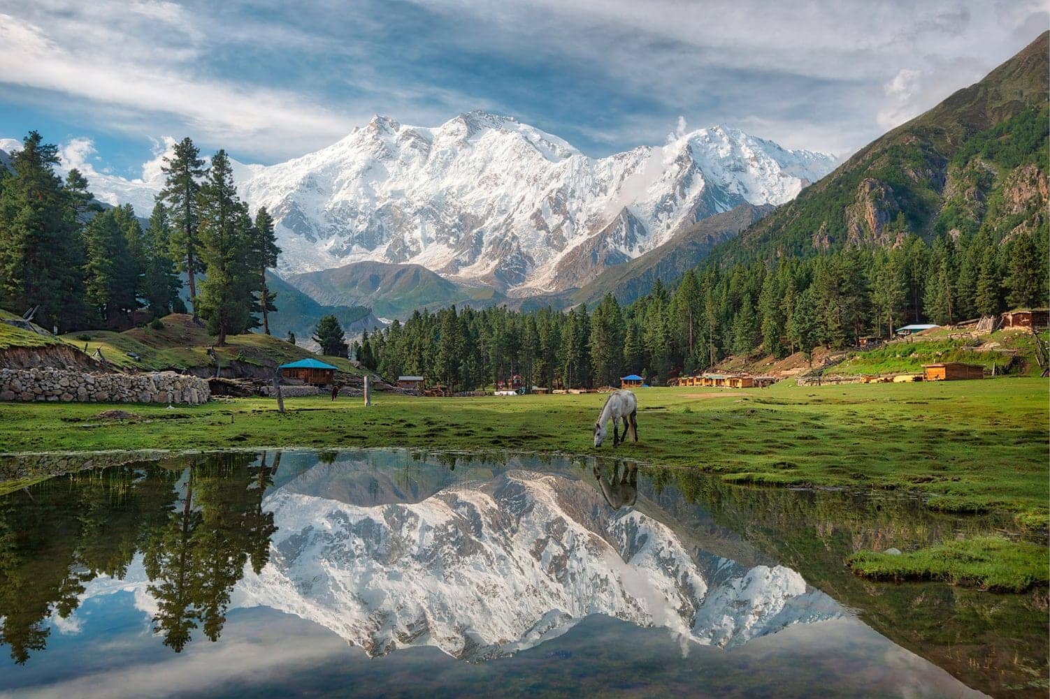
Fairy Meadows
A high-altitude grassland in Diamer District with direct views towards the Raikot side of Nanga Parbat, at approximately 3,300 metres, reached by jeep from the Karakoram Highway and a hike from Tattu village.
Explore Fairy Meadows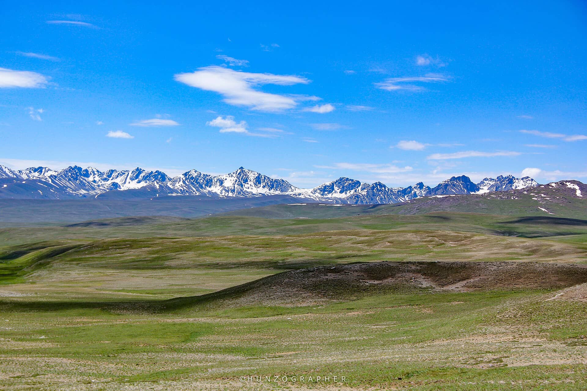
Deosai National Park
A vast alpine plateau between the Skardu and Astore districts at an average elevation of approximately 4,114 metres, with open plains, wetlands and habitat for the Himalayan brown bear.
Explore DeosaiKnow before you go
Astore and Rama currently have no dedicated destination page on this site. The Rupal side of Nanga Parbat is reached through Astore; the Raikot side is associated with Fairy Meadows and Beyal Camp. The warmer months, particularly May to September, are the most practical time to visit.
02 — The Karakoram in Pakistan
A Monumental Landscape of Rock and Ice
The Karakoram forms the high-mountain heart of Gilgit-Baltistan. It contains Pakistan's highest summit, four of the country's five eight-thousand-metre peaks, and some of its largest glacier systems. Central Karakoram National Park covers more than 10,500 square kilometres between the Gilgit and Skardu regions.
Elevation
8,611 metres
Range
Karakoram
Region
Baltistan, Gilgit-Baltistan
Best known for
Extreme altitude, technical climbing
Pakistan's Karakoram eight-thousanders
- ◆K28,611 m
- ◆Gasherbrum Iapprox. 8,080 m
- ◆Broad Peakapprox. 8,047 m
- ◆Gasherbrum IIapprox. 8,035 m
The fifth, Nanga Parbat, rises in the western Himalaya.
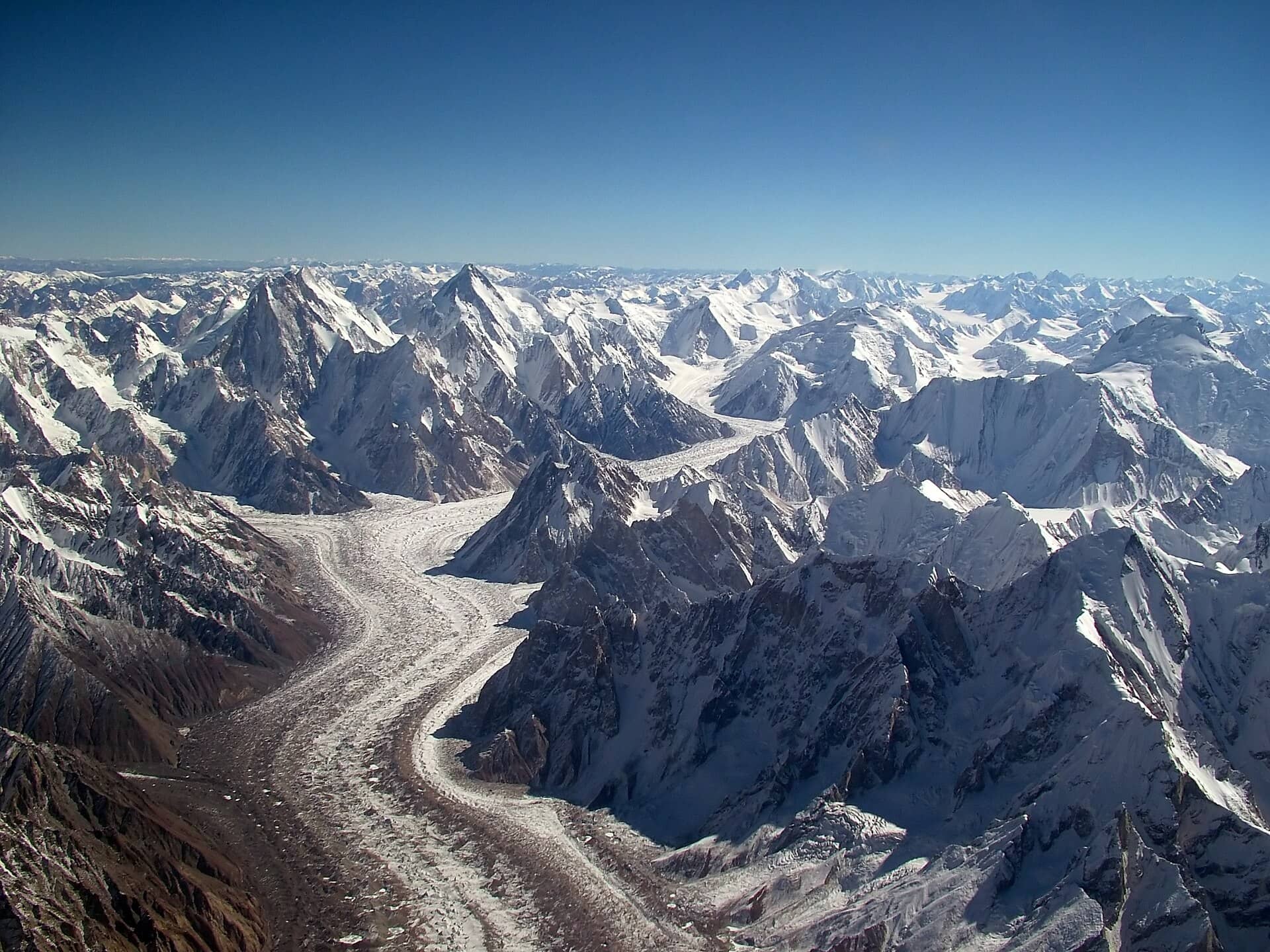
Baltoro and Concordia
One of Pakistan's most important expedition landscapes: glacier routes lead to Concordia, where several of the Karakoram's major peaks meet within one immense mountain arena.
Explore Baltoro and Concordia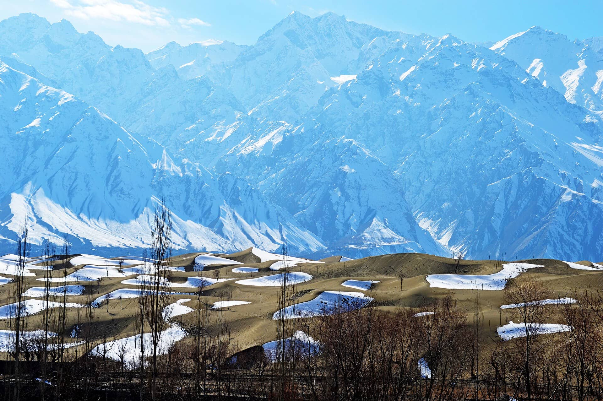
Skardu
The principal urban gateway to Baltistan, and to journeys towards Shigar, Askole, Baltoro and K2 base camp, with its own lakes, forts and cold-desert dunes nearby.
Discover Skardu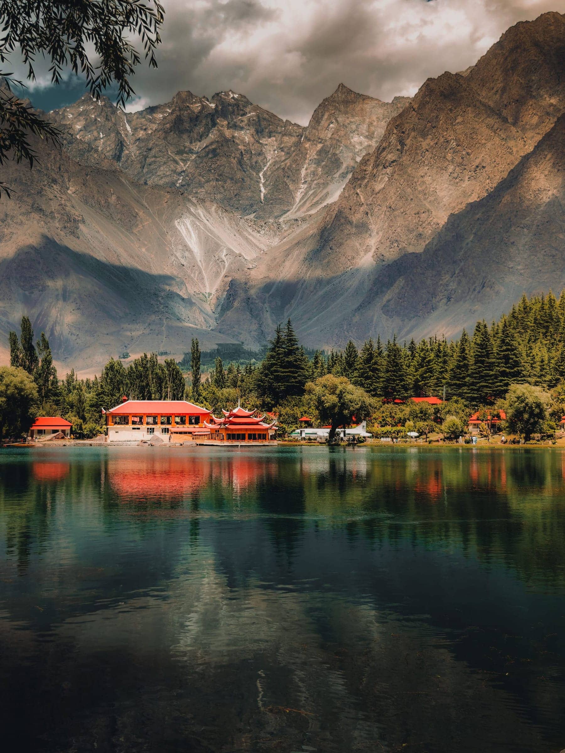
Shigar and Askole
Shigar combines cultivated valleys and traditional architecture around Shigar Lake; beyond it, Askole is the last permanent village on the established trekking approach to Baltoro.
View the Skardu and Shigar journeyHushe and Gondogoro
Hushe Valley provides access to a region of granite towers and high peaks in Ghanche District. The Gondogoro Pass route connects Hushe with the upper Baltoro region. At approximately 5,585 metres it involves steep snow, avalanche exposure, rockfall hazards and fixed ropes — a serious expedition route requiring professional organisation, not an ordinary hiking trail.
Know before you go
Shigar does not currently have its own dedicated destination page — it is covered by the Skardu, Deosai, Shigar, Hunza, Attabad and Khunjerab journey linked above. Hunza and Nagar are covered together by one regional hub page.
03 — The Hindu Kush in Pakistan
The Mountain World of Chitral
The Hindu Kush shapes much of Upper and Lower Chitral in Khyber Pakhtunkhwa and extends into western Gilgit-Baltistan through Ghizer, home to the valleys of Yasin, Ishkoman, Phandar and Gupis. Its Pakistani landscape is defined by isolated valleys, high passes, forests and mountain communities connected by routes that have carried travellers and traders for generations.
Elevation
approx. 7,708 metres
Range
Hindu Kush
Region
Upper Chitral, Khyber Pakhtunkhwa
Best known for
Highest summit of the Hindu Kush
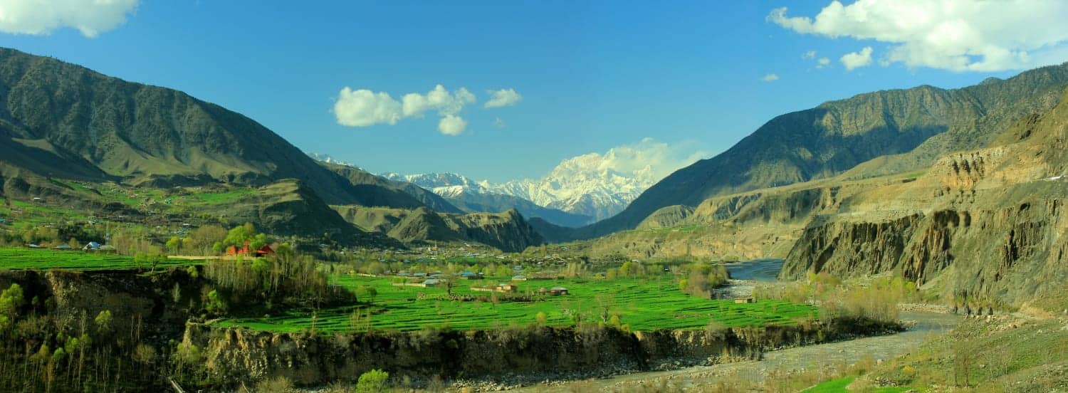
Chitral
The principal gateway to the Pakistani Hindu Kush, with routes towards Upper Chitral, Tirich Valley, Mastuj, Garam Chashma and the Kalash valleys.
Discover Chitral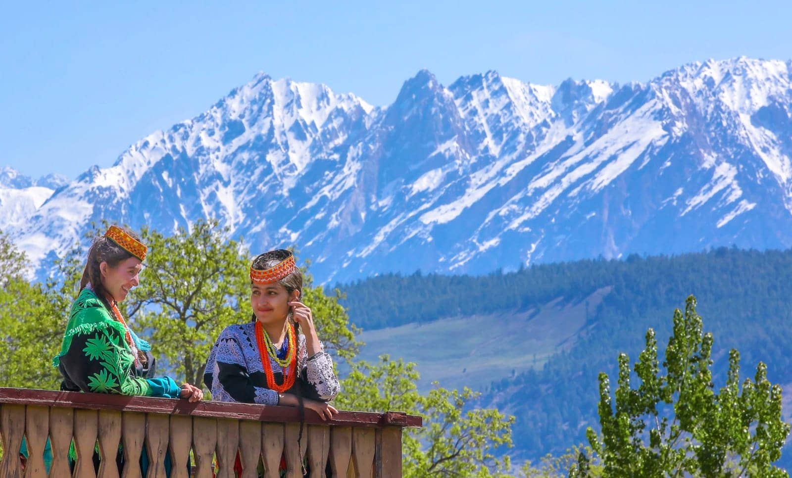
The Kalasha Valleys
Bumburet, Rumbur and Birir are home to the Kalasha community and form a living cultural landscape within the Hindu Kush, added to Pakistan's UNESCO Tentative List in March 2026.
Visit the Kalasha Valleys responsiblyShandur
Shandur Pass connects the mountain regions of Chitral and Gilgit-Baltistan through a high plateau at approximately 3,700 metres, best known for the Shandur Polo Festival. Access remains seasonal.
Know before you go
Upper Chitral, Ghizer and Yasin do not currently have their own dedicated destination pages — they are reached through and covered by the Chitral gateway page linked above.
Where the ranges meet
The Junction of Three Mountain Worlds
Near Bunji in Gilgit-Baltistan, the Himalaya, Karakoram and Hindu Kush come into close geographic contact around the upper Indus corridor. The Government of Gilgit-Baltistan Tourism Department describes the area as the Junction of Three Mountain Ranges. The exact geological boundaries between the three systems are complex; this description simplifies that geography for travellers, marking the point where their tourism identities visibly converge along the Karakoram Highway.
Glaciers and the Indus
Mountains of Ice, Rivers of Life
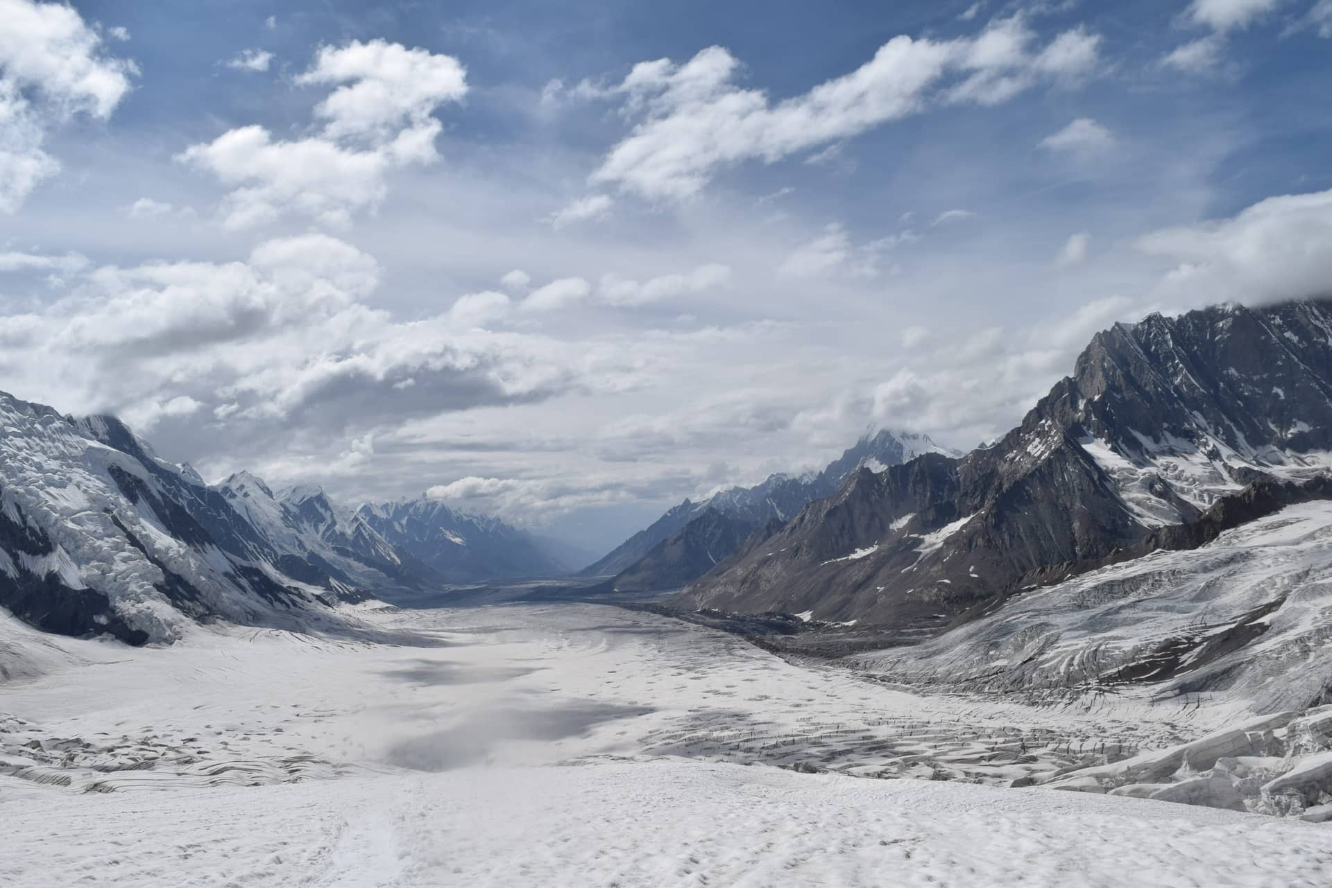
A national glacier inventory announced in 2024 recorded 13,032 glaciers across Pakistan's Hindu Kush, Karakoram and Himalayan regions. Many of these high-mountain ice reserves feed the wider Indus River system, which supports agriculture, hydropower and settlements well beyond the northern valleys.
Pakistan's glaciers are also associated with real environmental risks. Changing ice and snow conditions can contribute to unstable slopes, glacial lakes, flooding and disruption to roads and settlements. Responsible tourism includes respecting official warnings, local expertise and fragile mountain environments.
High-mountain cultures
Living Cultures of the High Mountains
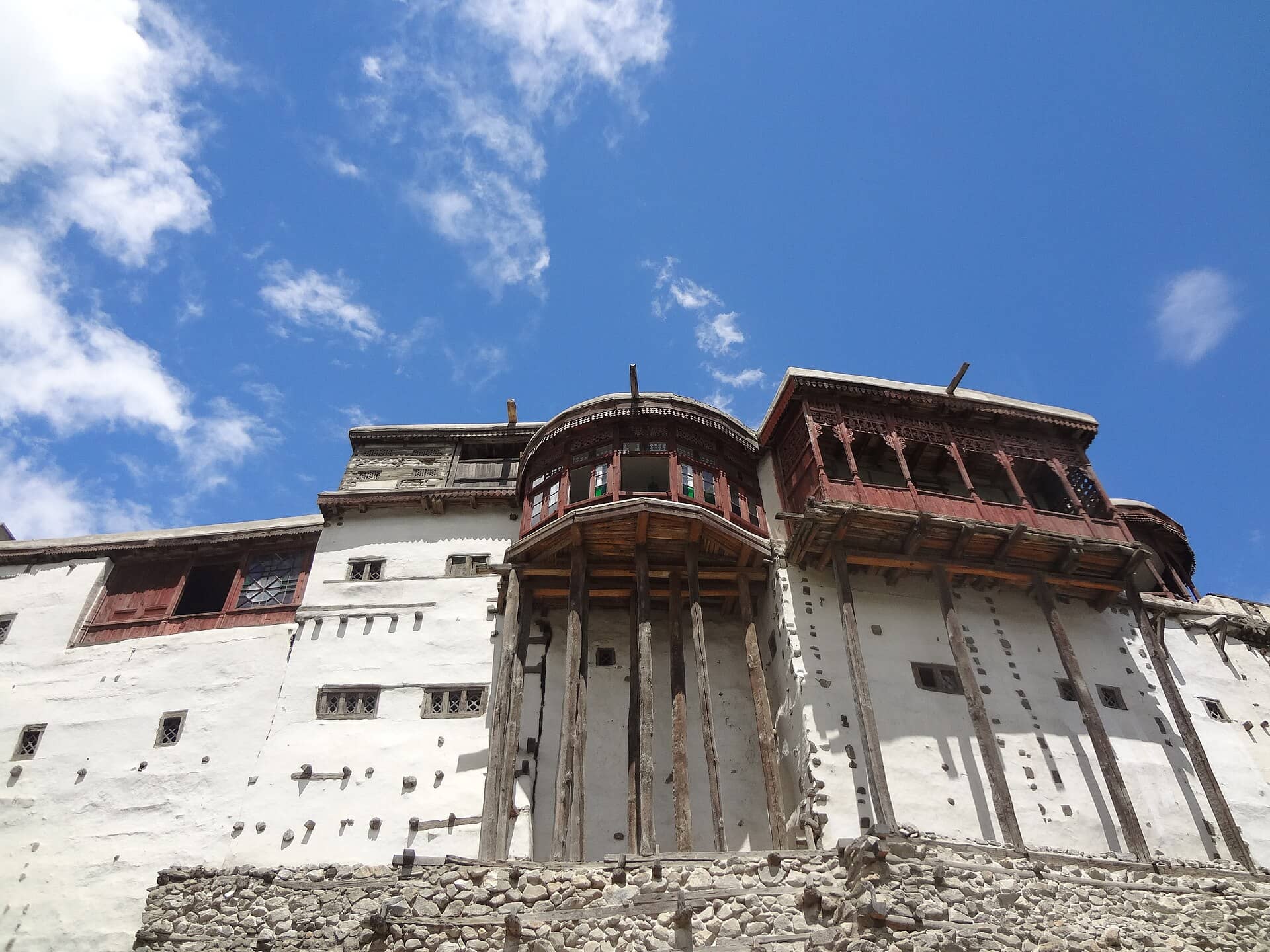
Pakistan's northern mountains are not empty wilderness. They are living cultural landscapes shaped by communities with distinctive settlement patterns, agricultural systems, architecture, languages and seasonal practices — from the valleys of Baltistan, Hunza and Nagar to Chitral, the Kalasha valleys, Yasin and Ghizer. Local life remains closely connected to water, pasture, orchards, livestock and seasonal access, and these are contemporary communities, not staged attractions.
- ✦Ask before photographing people, homes, ceremonies or sacred places.
- ✦Hire registered local guides.
- ✦Choose locally owned stays and services.
- ✦Buy regional crafts directly from responsible producers.
- ✦Follow community rules and do not treat ceremonies as staged attractions.
Gateways and destinations
Choose Your Gateway
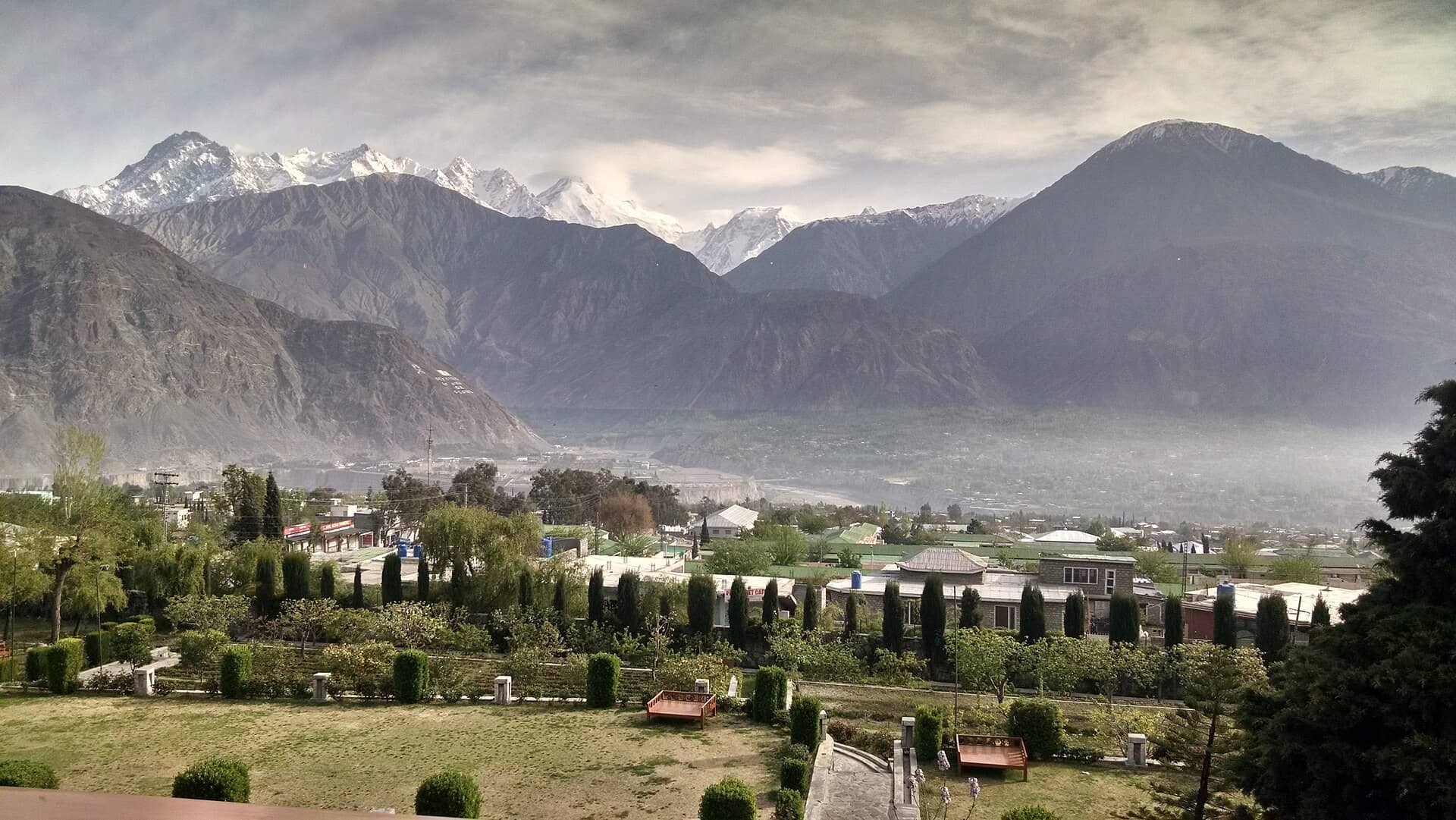
Gateway to all three ranges
Gilgit
Where journeys towards Hunza, Nagar, Baltistan and Chitral all begin.
Explore Gilgit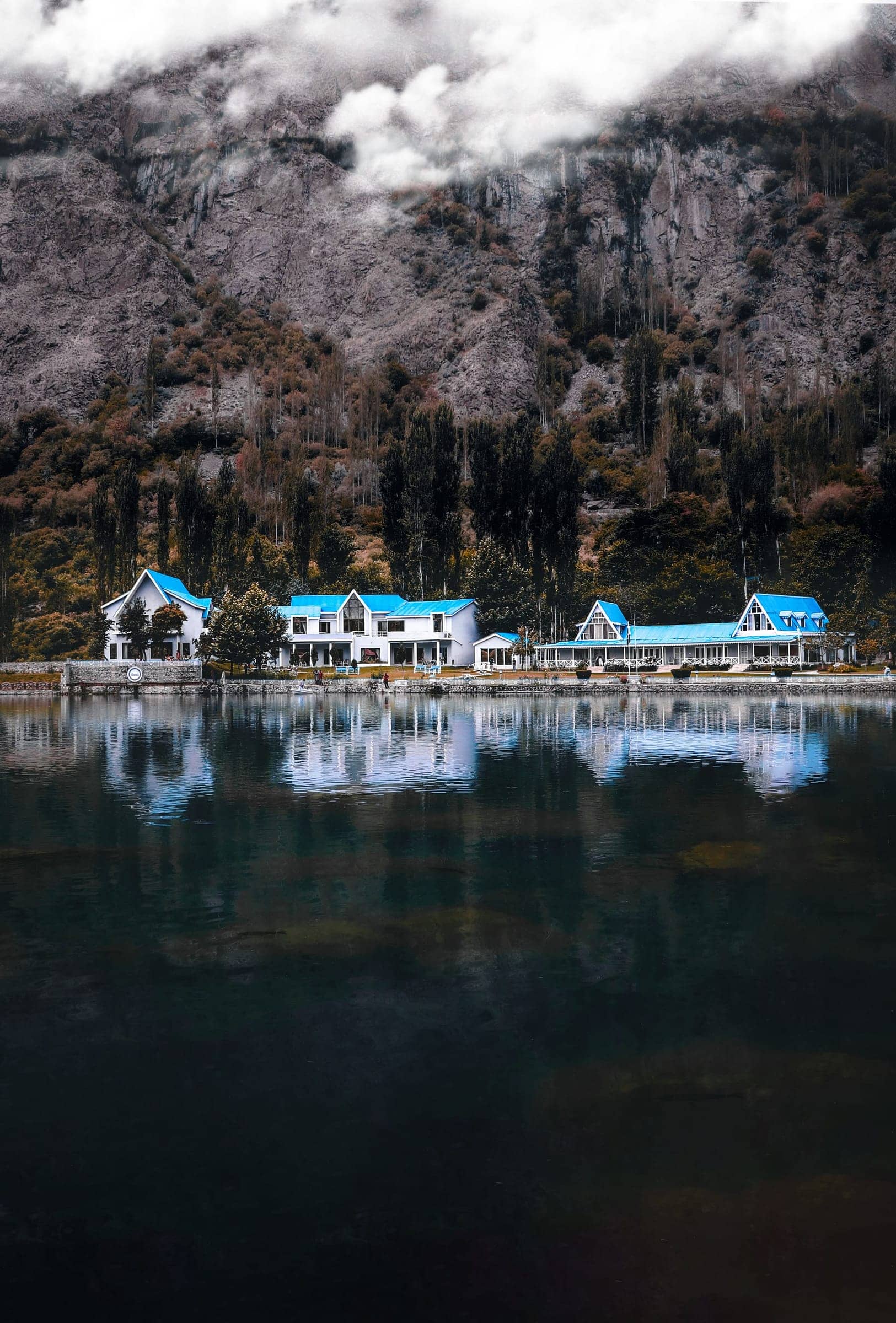
Gateway to the Karakoram
Skardu
Baltistan's principal town, and the last major stop before Shigar, Askole and K2 base camp.
Discover SkarduGateway to the accessible Karakoram
Hunza and Nagar
Terraced valleys, historic forts and views of Rakaposhi, Diran and Ultar Sar.
Explore Hunza and Nagar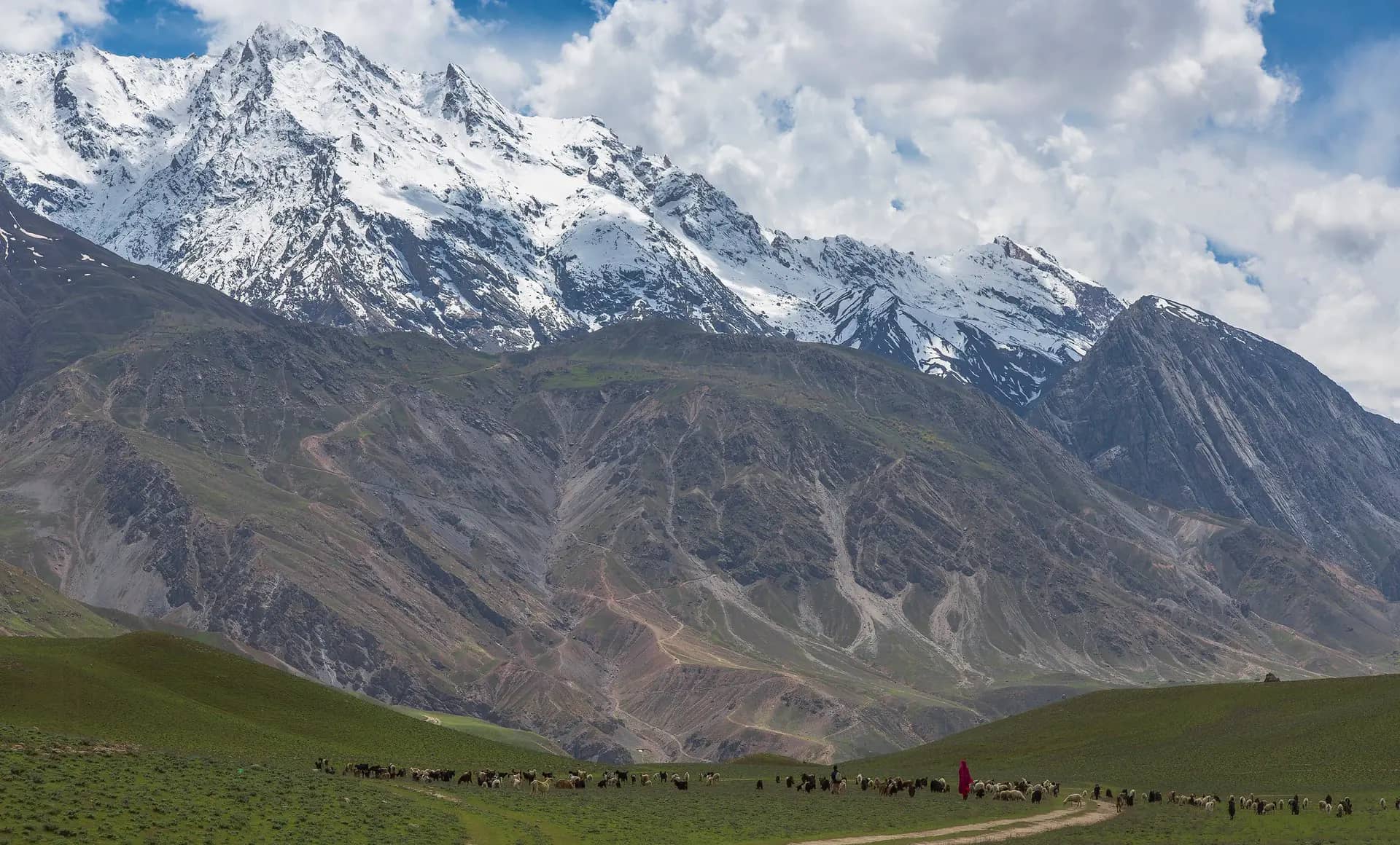
Gateway to the Hindu Kush
Chitral
Mountain scenery, living communities and the road towards Shandur.
Discover Chitral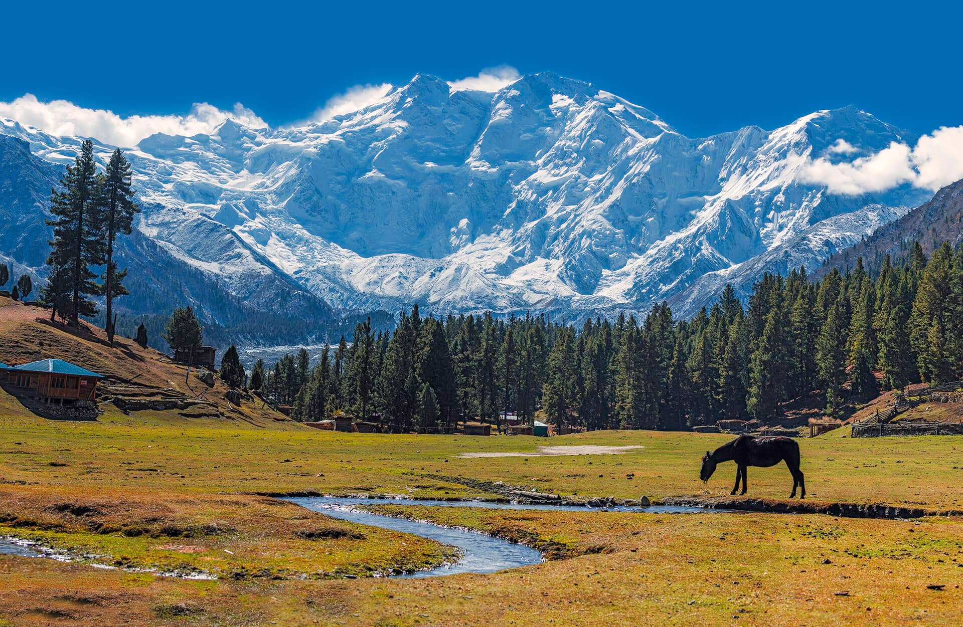
Gateway to Nanga Parbat
Fairy Meadows
The best-known accessible viewpoint for the Raikot side of Nanga Parbat.
Explore Fairy MeadowsLiving cultural landscape
The Kalasha Valleys
Bumburet, Rumbur and Birir, home to the Kalasha community.
Visit the Kalasha Valleys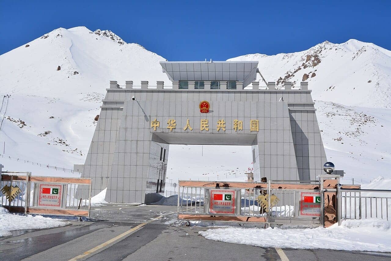
Gateway to the border
Khunjerab
One of the world's highest paved international border crossings, in upper Hunza.
Journey to KhunjerabPlan your journey
Choose Your Mountain Journey
Scenic Karakoram road journey
The classic Karakoram Highway corridor from the junction of the three ranges at Jaglot, through Gilgit and Hunza, to Khunjerab Pass.
- Best season:
- May to October
K2 and Baltoro trekking
Concordia, K2 base camp and the Gondogoro La crossing — a serious, porter-supported expedition trek.
- Duration:
- 21 days / 20 nights
- Difficulty:
- Strenuous
Skardu, Shigar and Hunza journey
The full northern arc — Deosai, Shigar, Hunza, Attabad Lake and Khunjerab.
- Duration:
- 12 days
Hunza valley journey
Terraced villages, historic forts and Karakoram views, more accessible than expedition terrain.
Explore Hunza and NagarKalasha cultural journey
Bumburet, Rumbur and Birir — a living cultural landscape within the Hindu Kush.
Visit the Kalasha ValleysMountain stays and guided tours
Browse eco-conscious stays and guided tours across the mountain north.
Find mountain staysBest seasons
When to Visit
Late spring
Lower valleys, orchards, cultural travel and road journeys where seasonal routes have reopened.
Higher passes and plateaus may still be closed by snow.
Summer
The main access season for high plateaus, remote valleys, mountain passes and major trekking areas.
Peak season means busier roads and stays; book ahead.
Early autumn
Clearer mountain views, changing foliage and quieter valley travel.
Nights turn cold quickly; high-altitude conditions can change fast.
Winter
Specialised, cold-weather travel only in accessible lower valleys.
Heavy snow closes many passes and can isolate settlements; Khunjerab and Deosai are not accessible.
Conditions vary by elevation and location. Mountain roads, passes and trails may close because of snow, landslides, flooding or maintenance. Confirm current conditions before departure.
Peak explorer
Named Peaks by Elevation
A reference of named peaks across Pakistan's three mountain ranges, grouped by elevation band.
8,000 m and Above
| Peak | Range | Region | Elevation |
|---|---|---|---|
| K2 | Karakoram | Baltistan, Gilgit-Baltistan | 8,611 m |
| Nanga Parbat | Himalaya | Diamer, Gilgit-Baltistan | 8,126 m |
| Gasherbrum I | Karakoram | Baltistan, Gilgit-Baltistan | approx. 8,080 m |
| Broad Peak | Karakoram | Baltistan, Gilgit-Baltistan | approx. 8,047 m |
| Gasherbrum II | Karakoram | Baltistan, Gilgit-Baltistan | approx. 8,035 m |
7,000 m
| Peak | Range | Region | Elevation |
|---|---|---|---|
| Distaghil Sar | Karakoram | Hunza, Gilgit-Baltistan | approx. 7,885 m |
| Rakaposhi | Karakoram | Nagar, Gilgit-Baltistan | 7,788 m |
| Masherbrum | Karakoram | Baltistan, Gilgit-Baltistan | approx. 7,821 m |
| Tirich Mir | Hindu Kush | Upper Chitral, Khyber Pakhtunkhwa | approx. 7,708 m |
6,000 m
A verified peak-by-peak reference at this elevation band requires the source mountaineering map, which was not available for this update. See Sources and methodology below.
5,000 m
A verified peak-by-peak reference at this elevation band requires the source mountaineering map, which was not available for this update. See Sources and methodology below.
4,000 m and Below
A verified peak-by-peak reference at this elevation band requires the source mountaineering map, which was not available for this update. See Sources and methodology below.
Mountain safety
Conditions Can Change Rapidly
Conditions in northern Pakistan can change rapidly. Road closures, snowfall, landslides, flooding and altitude may affect journeys even during the main travel season.
Altitude and acclimatisation
- ✦Allow time for gradual acclimatisation before going higher.
- ✦Know the signs of altitude illness and descend if they appear.
Weather and temperature
- ✦Mountain weather changes quickly; carry clothing for sudden cold, wind and rain.
- ✦Check forecasts before setting out each day.
Roads, passes and trail conditions
- ✦Confirm current road and pass status before travelling.
- ✦Landslides, snow and flooding can close routes with little notice.
Guides, permits and registration
- ✦Use registered local guides for remote or high-altitude routes.
- ✦Confirm permit and registration requirements in advance.
Communications and emergency preparation
- ✦Coverage is limited in many valleys; plan accordingly.
- ✦Keep emergency contacts and accommodation details available.
Insurance and evacuation capability
- ✦Confirm your travel insurance covers high-altitude trekking and evacuation.
- ✦Understand realistic evacuation timeframes before committing to remote routes.
Glacier and technical terrain
- ✦Do not enter glaciers without appropriate experience and equipment.
- ✦Do not attempt technical passes as independent sightseeing trips.
Gondogoro Pass, for example, includes steep snow slopes, fixed-rope sections, avalanche exposure and rockfall hazards. It requires technical preparation and professional support, not casual attempt.
This page does not replace official government travel advice, district administration and disaster-management guidance, qualified mountain guides, expedition organisers, or current local information. A dedicated permits and emergency-contacts page does not currently exist on this site.
Responsible tourism
Travel Responsibly
Respect communities
Ask before photographing people, homes, ceremonies or sacred places.
Support local livelihoods
Choose locally owned stays, guides, transport and craft businesses.
Protect water
Avoid contaminating streams, lakes and glacier-fed water sources.
Carry waste out
Leave no rubbish at campsites, valleys or trekking routes; reduce disposable plastic.
Protect wildlife
Observe animals from a distance; never feed or disturb them.
Stay on established routes
Use established campsites; do not remove plants, rocks or cultural objects.
Sources and Methodology
Glacier count: 13,032 glaciers, from a national glacier inventory announced by the Government of Pakistan on 7 November 2024. Earlier figures cited elsewhere (such as 7,200+) reflect older inventory methods and are not presented here as equivalent totals — glacier counts change as inventory methods and mapping improve.
Peak elevations: commonly cited mountaineering figures for Pakistan's named 8,000 m and 7,000 m peaks. Elevation-band groupings below 7,000 m are not populated in the Peak explorer above, as a verified peak-by-peak reference at that level of detail was not available for this update.
Map: the diagram in the Geographic orientation section is an original, simplified schematic for orientation only. It is not to scale, not a surveyed map, and summit and range positions are illustrative.
Editorial content: place descriptions and practical guidance draw on this project's existing, previously fact-checked destination pages, area guides and route data.
Conditions change: road, trail, glacier, permit and weather conditions change frequently. Always confirm current conditions independently before travelling.
Page last fact-checked: July 2026.
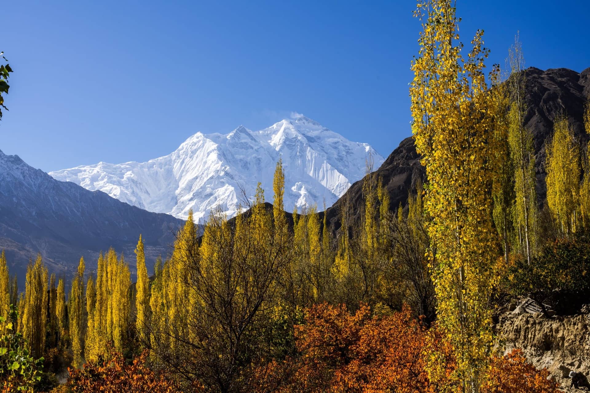
Begin Your Journey Into Pakistan's Mountain North
Choose the range, season and travel style that suit your trip, then build your route through the Himalaya, Karakoram or Hindu Kush.